So after looking at the GPS data I collected, I figured I would try another data collection in 2D mode with the know altitude set. That would allow me to use one more satellite for horizontal position. I collected 12 hours of data and if was even worst than the 3D solution. So I got to thinking.What I was seeing (+- 4 meter errors) just did not make sense. GPS is good for much better than that by spec. True, if you have a bad constellation, your error can go out the window. But that was not my case. And then it hit me. The data I was collection was using an indoor GPS broadcaster. We have a GPS antenna on the roof and a radiator inside (FAA approved) that allows us to test GPS equipment indoors. Perhaps that was introducing errors?
Sure enough it was. I took the GPS out to an open parking lot and collected 30 minutes of data and had error mostly inside a 1 meter radius. Here is the new wander plot:
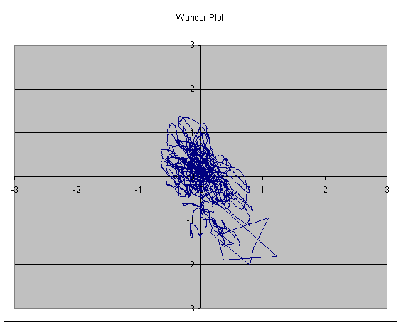
Much better. That rather large star shaped error was very early on in the data collect before the GPS had gotten all the almanac and ephemeris data.
Now I can breath a sign of relief, and I can warn the other lab users not to trust the results from the broadcaster for accurate results.